
Industries We Serve
Tailored Drone Solutions for Every Industry

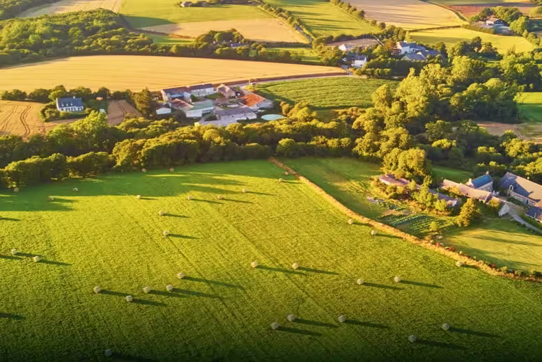
Agriculture & Farming
Transform your agricultural operations with advanced drone technology designed for precision farming, crop health monitoring, and automated spraying systems.
Key Applications
Key Benefits
- Reduce chemical usage by up to 30%
- Cover 10-15 hectares per hour
- Increase crop yields by 15-20%
- Real-time crop health insights
- Lower operational costs
Recommended Solutions
Agricultural Spray Drones
10L-50L capacity with precision nozzle control
Multispectral Cameras
NDVI and crop health analysis sensors
Field Mapping Systems
High-resolution aerial surveying
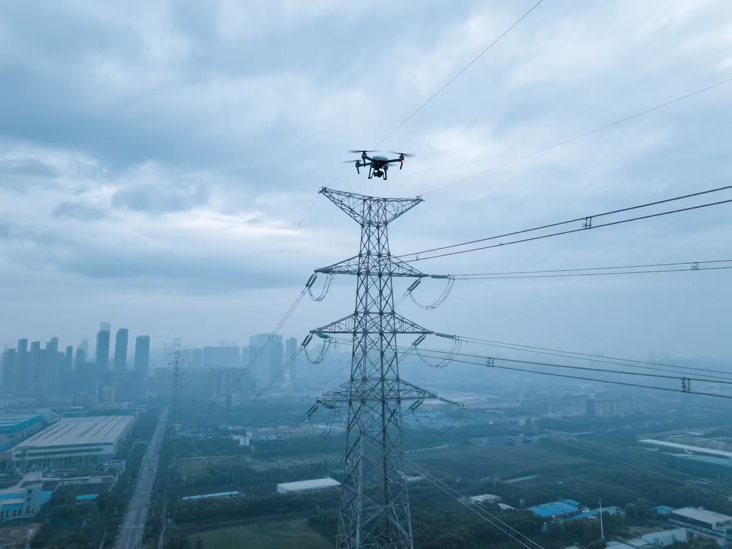
Industrial Inspection
Enhance safety and reduce costs with drone-based inspection solutions for power lines, pipelines, wind turbines, and industrial facilities.
Key Applications
Key Benefits
- Reduce inspection time by 70%
- Eliminate high-risk manual inspections
- Detect issues early with thermal imaging
- Comprehensive visual documentation
- Lower insurance and liability costs
Recommended Solutions
VTOL Inspection Drones
Long-range fixed-wing with vertical takeoff
Thermal Imaging Systems
High-resolution thermal cameras for defect detection
Zoom Camera Payloads
30x optical zoom for detailed inspection

Surveying & Mapping
Deliver accurate topographic surveys, 3D models, and GIS data with our professional surveying drone systems equipped with PPK/RTK technology.
Key Applications
Key Benefits
- Centimeter-level accuracy with RTK
- 10x faster than traditional methods
- Comprehensive 3D terrain models
- Regular progress monitoring
- Reduced surveying costs
Recommended Solutions
RTK/PPK Survey Drones
High-precision positioning systems
LiDAR Payloads
3D point cloud data capture
Photogrammetry Software
Professional mapping and modeling tools

Public Safety & Emergency Response
Equip your emergency response teams with advanced drone technology for search and rescue, disaster assessment, and public safety operations.
Key Applications
Key Benefits
- Rapid deployment in emergencies
- Enhanced situational awareness
- Thermal imaging for night operations
- Safe reconnaissance in hazardous areas
- Real-time video streaming
Recommended Solutions
Thermal Imaging Drones
Dual thermal/visible cameras for all conditions
Communication Relay Systems
Aerial communication nodes
Spotlight & Speaker Payloads
Night operations and public address
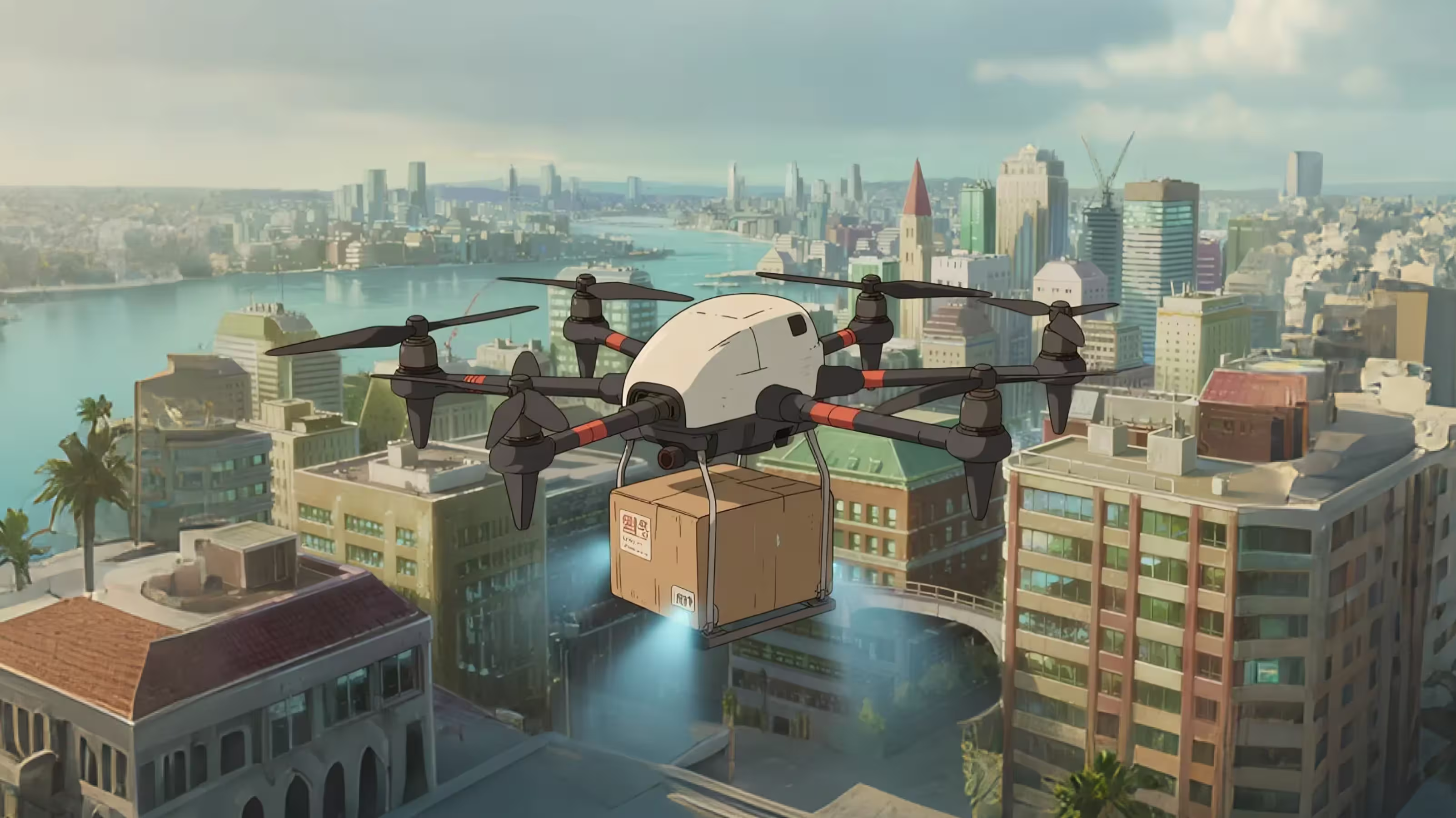
Delivery & Logistics
Revolutionize your delivery operations with autonomous drone systems designed for efficient last-mile delivery and remote area logistics.
Key Applications
Key Benefits
- Reduce delivery costs by 40%
- Reach remote locations easily
- Fast delivery times (under 30 minutes)
- Environmentally friendly
- Automated flight operations
Recommended Solutions
Cargo Delivery Drones
5-20kg payload capacity systems
Automated Landing Stations
Precision landing and package handling
Fleet Management Software
Multi-drone coordination and tracking
Construction & Real Estate
Streamline construction project management and enhance property marketing with professional aerial photography and progress monitoring.
Key Applications
Key Benefits
- Weekly progress documentation
- Identify issues before they escalate
- Stunning marketing materials
- Improved stakeholder communication
- Reduced site visits
Recommended Solutions
4K Camera Drones
Professional aerial photography systems
Time-Lapse Solutions
Automated progress documentation
3D Modeling Services
BIM integration and site models
Ready to Transform Your Operations?
Contact our industry experts to discuss your specific requirements
Get Started Today